|
|
||
|
|
||
|
|
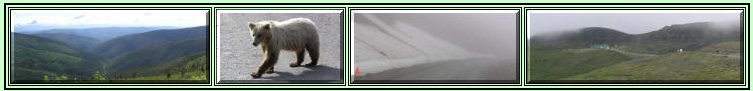
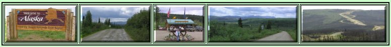
Top of the World Highway |
|
|
June 2006 |
||
|
This 184-mile trek across the mountains is a truly scenic route, paved on the Canadian side, though there were numerous soft spots and breaks. On the U.S. side it is gravel with some steep grades and winding sections. The views are so expansive, that photographs just do not capture the spectacle. We waited an extra day in Dawson City for a break in the rainy weather and were rewarded with mostly sunshine for the first 55 miles. The last 10 miles to the border were over the highest peaks, in rain and fog, providing a few white knuckle moments. We had one encounter with a brown bear that has us scrambling for batteries for the camera, but the bear obliged us by giving the motorhome and car a good inspection. We finally pulled away when he was getting too close. The section of highway from Chicken to Tok in Alaska is actually the Taylor Highway. On that stretch of highway we passed through some of the 1.3 million acres burned in the Taylor Complex 2004 fires. |
||