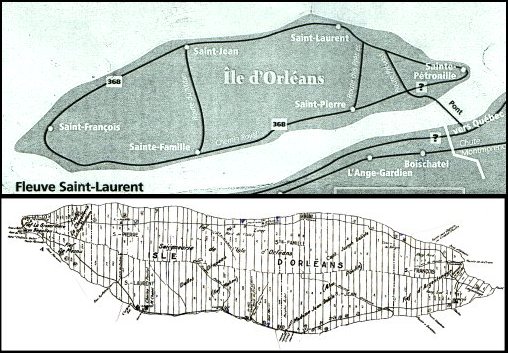

The top map shows the villages that make up the island. The positioning of the bottom map is as a mirror image of the top map, so that Saint-Jean and Saint-Laurent are at the bottom of the map instead of at the top. The current Roberge farm is located to the left of Saint-Pierre on the top map (about where the highway marker is shown).
The bottom map shows the way the land was platted in 1689 in long, narrow strips so that each farmer had access to the water, which was the only means of transportation off the island.